Two storms in November have brought snow to the Sierra Nevada, marking a "rapid start to the wet/snowy season" for California, Nevada and other parts of the western United States.
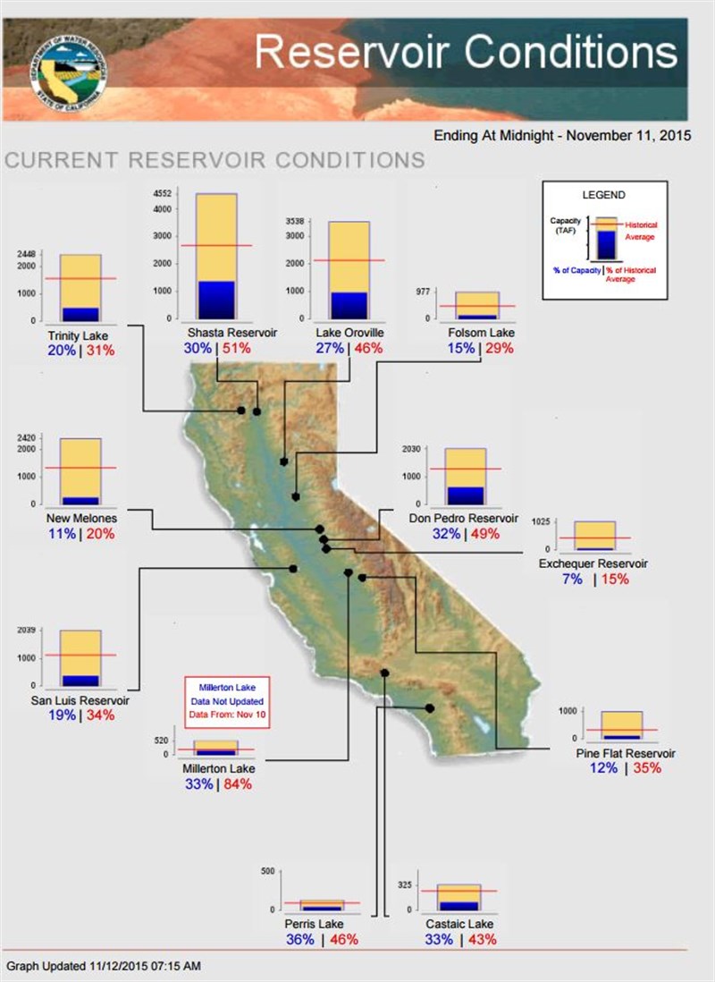
But, it will take much more of the same to make a dent in California’s historic four-year drought.
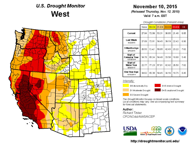
"Snowpack is well above normal for this time of year in the Sierra Nevada and parts of Nevada where drought has seemed intractable, Reno-Tahoe Airport recorded 4.2” of snow November 9-10 (including a daily record 2.4” on the 9th), and over a foot blanketed some areas northeast of the city," according to the U.S. Drought Monitor released November 12.
"But given the long-term nature of the drought in much of the Far West, only scattered areas of improvement were noted," the report said.
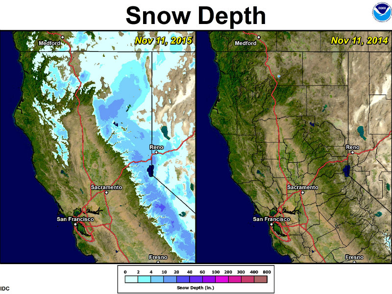
Still, with many ski resorts opening earlier than planned in California and Nevada, after four years of drought, the snow in the Sierra is a welcome sign.
 Boreal Mountain Resort was one of several California ski resorts that opened earlier than normal in November 2015 after recent storms brought snow. Andrew Nixon / Capital Public Radio
The drought monitor reported that "moderate to heavy precipitation fell on the Sierra Nevada, northwestern California, western sections of Washington and Oregon, northern sections of the Rockies and Intermountain West, scattered areas from western Colorado to central Arizona, and a few other isolated spots. Other locations received little, if any."
The weekly update reports that the "wet/snowy season is off to a rapid start in the Intermountain West and West Coast States" but also says "areas where drought was more entrenched [California] will need abundant precipitation to continue much farther into the wet season before any notable improvement could evolve."
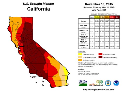
In California, there was no change this week in the percentage of drought intensity: 92 percent is in severe drought, 70 percent is in extreme and 44 percent is in exceptional drought.
There was a slight decrease in exceptional drought (9.3 percent) in Nevada, but the state remained 73 percent in severe drought and 32 percent in extreme drought.
The Drought Monitor intensity levels are Abnormally Dry, Moderate, Severe, Extreme and Exceptional Drought.
Other parts of the western U.S. fared better over the last week.
Severe drought eased to moderate levels in central Washington, abnormal dryness was eliminated in northwestern Colorado and there was slight improvement in Idaho, Montana and Arizona.
Oregon and Washington remain 100 percent in moderate drought. But severe drought in Washington was reduced to 66 percent.
Extreme drought covered 60 percent of Oregon and nearly 48 percent of Washington last week.
Meteorologist Brooke Bingaman with the National Weather Service in Sacramento says another storm is forecast to bring more snow to Sierra next weekend. She says rain will also come to the valleys, "but we need that snowpack to really help pull us out of the drought."
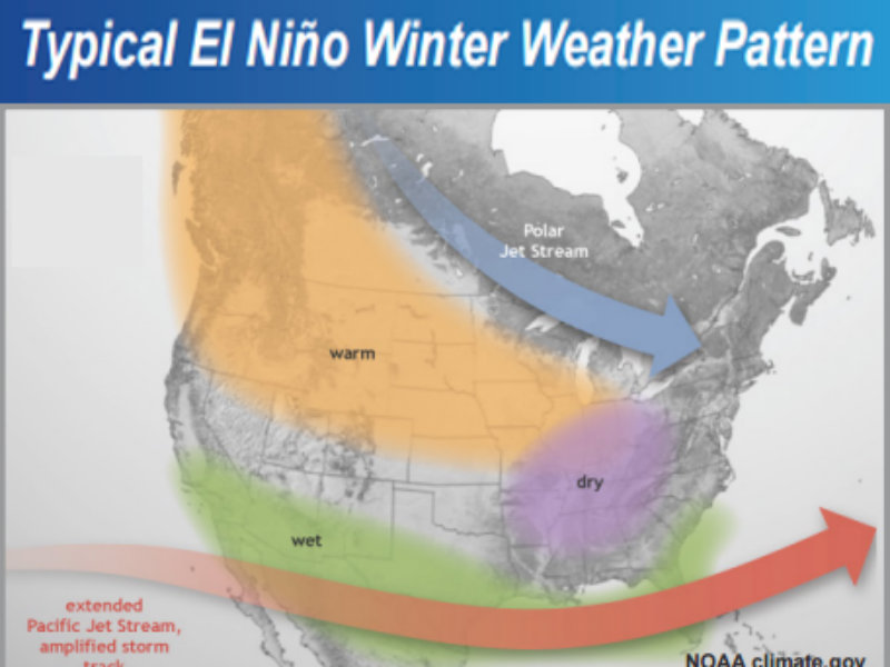
The latest El Niño update from the National Weather Service Climate Prediction Center says a strong El Niño continued during October "as indicated by well above-average sea surface temperatures across the central and eastern equatorial Pacific Ocean."
"El Niño has already produced significant global impacts," according to the Nov.12 update. "El Niño is expected to affect temperature and precipitation patterns across the United States during the upcoming months."
"Seasonal outlooks generally favor below-average temperatures and above-median precipitation across the southern tier of the United States, and above-average temperatures and below-median precipitation over the northern tier of the United States," according to the NWS Climate Prediction Center.
CapRadio provides a trusted source of news because of you. As a nonprofit organization, donations from people like you sustain the journalism that allows us to discover stories that are important to our audience. If you believe in what we do and support our mission, please donate today.
Donate Today