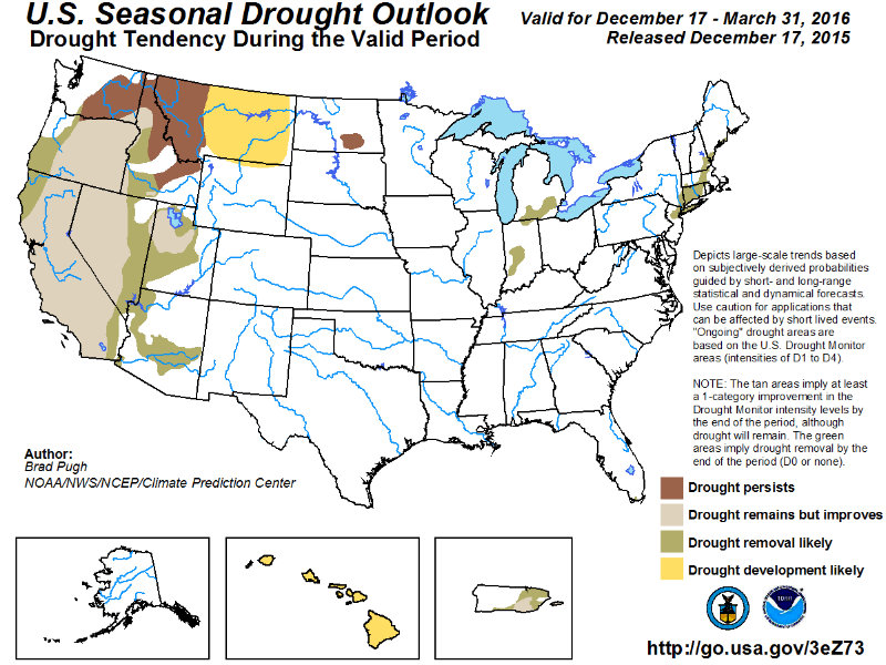
The U.S. Drought Monitor released January 28 partly credits El Niño moisture for "some modest dents in the armor of the multi-year drought in California."
"Slow and steady recovery continues for parts of the West this week after another beneficial round of precipitation brought with it liquid equivalent totals running from 5 to 8 inches or more in some spots in the northern Sierra Nevada and Cascade Ranges," according to the weekly update.
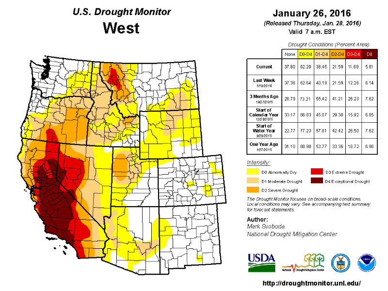
The report says "there are finally some signs that some modest dents in the armor of the multi-year drought in California are appearing."
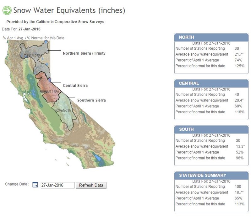
"Now that Water-Year-to-date precipitation has eliminated most of California’s short-term ("S") drought (now contained to just the west-central coast), continued recovery in soil moisture, long-term average streamflow, well above normal snow water content (150-180% of normal) and a trend up in reservoir levels has led to some slight improvement in the water supply situation and to the long-term ("L") drought in northern California as well," the report noted.
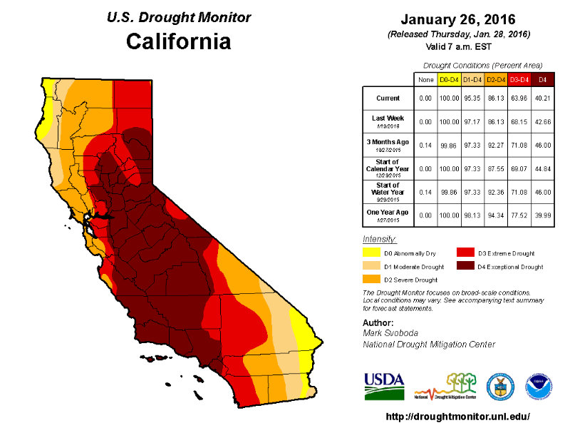
The Drought Monitor intensity levels are Abnormally Dry, Moderate, Severe, Extreme and Exceptional drought.
In California, 100 percent of the state is abnormally dry.
There was improvement in California the past week: Moderate drought declined to 95 percent (from 97 percent), extreme drought was reduced to about 64 percent (from 68 percent) and exceptional drought is 40 percent, down from 42.66 percent.
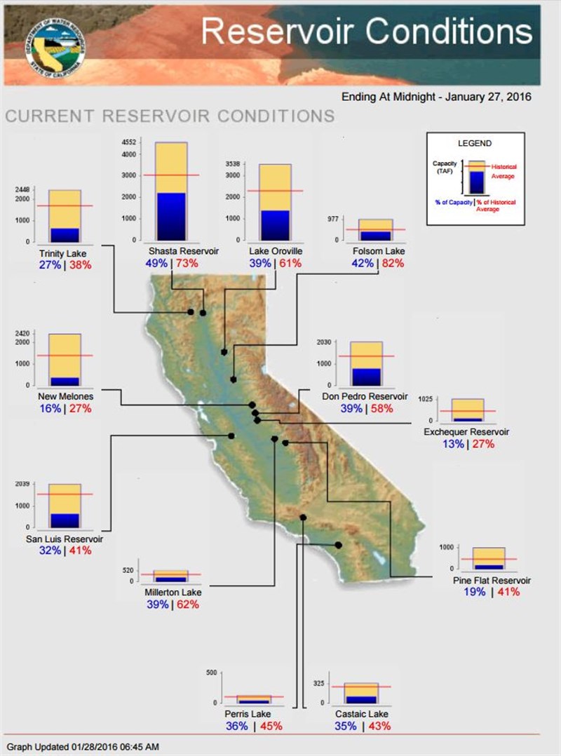
The Drought Monitor says there has been improvement and a push of abnormally dry, moderate, severe and extreme drought [D0-D3] "eastward off the coast from San Francisco up to Eureka. In addition, an area in the northern Sierra Nevada range has moved from exceptional drought to extreme drought [D4 to D3] given above-normal snowpack and snow water content on the Water Year."
"In what must seem like a broken record (or perhaps a repeat track on Spotify if you fancy the digital realm) we must stress that this doesn’t mean the region is out of drought, as many of the larger reservoirs in northern California and southern Oregon are still below half of capacity," cautioned the Drought Monitor. "That is the reason for the long-term hydrological "L" label remaining well entrenched over the region at this time. Relative to last year, though, the trend is going in the right direction for now with a good chunk of the snow season still left to play out over the next two months."
Follow us for more stories like this
CapRadio provides a trusted source of news because of you. As a nonprofit organization, donations from people like you sustain the journalism that allows us to discover stories that are important to our audience. If you believe in what we do and support our mission, please donate today.
Donate Today